On Literary Cartography: Narrative as a Spatially Symbolic Act
by Robert T. Tally Jr.
published January 2011
The experience of being in the world is one of constant navigation, of locating oneself in relation to others, of orientation in space and in time, of charting a course, of placement and displacement, and of movements though an array of geographical and historical phenomena. The human condition is one of being “at sea”—both launched into the world and somewhat lost in it—and, like the navigator, we employ maps, logs, our own observations and imagination to make sense of our place. As Frank Kermode notes in The Sense of an Ending, “Men, like poets, rush ‘into the middest,’ in medias res, when they are born; they also die in mediis rebus, and to make sense of their span they need fictive concords with origins and ends, such as give meaning to lives and to poems” (7). Kermode is speaking of temporal organization, but this experience of being “in the middest” is also acutely spatial, and it calls for cartographic solutions that are likewise “fictive concords” with here and there, near and far, home and away, and so on. Humans come to terms with this reality by projecting imaginary lines—latitude and longitude are obvious examples—inventing provisional landmarks or making narratives.
An approach to narrative as a spatially symbolic act enables us to navigate literature and the world in interesting new ways, by asking different questions, exploring different territories, and discovering different effects. As writers map their worlds, so readers or critics may engage with these narrative maps in order to orient ourselves and make sense of things in a changing world.

In the twenty-first century, this approach may be all the more pressing, as many of the former guideposts or points of reference (including even geographical ones, such as national borders) have disappeared or become less reliable. For instance, the current financial crisis has highlighted the degree to which even quite local matters (like home-ownership) are bound up in a global network that is beyond the ken of most of us, involving exotic securities and derivatives (e.g., collateralized debt obligations) traded off-exchange and offshore, and yet these may have devastating effects. Mapping this condition seems all the more necessary and all the less possible, but—if I may use a very old fashioned term—the attempt to do so is essential to the human condition.
Navigation is thus a figure for one’s existential condition and for literature. From a phenomenological perspective, the subject must attempt to understand the world by performing a kind of cartographic activity. Fredric Jameson has called this sort of cartographic activity “cognitive mapping,” a relational framework that enables “a situational representation on the part of the individual subject to that vaster and properly unrepresentable totality which is the ensemble of society’s structures as a whole” (Postmodernism 51–54). Mapping establishes a meaningful framework for the subject, with points of reference for thinking about oneself and one’s place in the broader social space. Likewise, narratives are frequently used to make sense of, or give form to, this world in significant ways. As such, literary works serve a cartographic function by creating a figurative or allegorical representation of a social space, broadly understood. This I refer to as literary cartography.
In his Theory of the Novel, Georg Lukács contrasts the closed or integrated civilization of the ancient epic and the fragmented world of the novel, and his rhetoric implies the sort of cartographic anxiety that calls for narrative maps. The epic hails from that “happy age” when “the starry sky is the map of all possible paths […] The world is wide and yet it is like a home” (29). The modern condition, whose representative form is the novel, is marked by a split between interior and exterior or between the subject and the world, which is now “a world abandoned by God” and characterized by a “transcendental homelessness” (Lukács 88, 41). This existential anxiety translates into a bewilderment in space, as one can no longer feel “at home” in the word. As Heidegger puts it in Being and Time, “In anxiety one feels ‘uncanny’ [unheimlich]. Here the peculiar indefiniteness of that which Dasein finds itself alongside in anxiety, comes proximally to expression: the ‘nothing and nowhere’. But here ‘uncanniness’ also means ‘not-being-at-home’ [das Nicht-zuhause-sein]” (233). The age of the novel is marked by an uncanny homelessness that requires a figurative way to connect oneself to one’s world. And that is what the novel becomes, a literary cartography providing figurative or allegorical images of the world and one’s place in it.

This cartographic project of the novel is much like Jameson’s conception of cognitive mapping as a strategy for situating oneself within a complex and seemingly unrepresentable social totality. Jameson famously derives the concept from Kevin Lynch’s analysis of urban disorientation in Image of the City and from Louis Althusser’s revisionary theory of ideology as an imaginary solution to real contradictions. It is worth noting, however, that Jameson first used the term (albeit a somewhat different way) in reference to narrative in The Political Unconscious, where he posits realism as “a narrative discourse which unites the experience of everyday life with a cognitive, mapping, or well nigh ‘scientific’ perspective” (90). Narrative itself is a form of mapping, organizing the data of life into recognizable patterns with it understood that the result is a fiction, a mere representation of space and place, whose function is to help the viewer or mapmaker, like the reader or writer, make sense of the world. In Maps of the Imagination, Peter Turchi asserts that all writing is in one way or another cartographic, but that storytelling is an essential form of mapping, of orienting oneself and one’s readers in space. The storyteller, like the mapmaker, determines the boundaries of the space to be represented, selects the elements to be included, establishes the scope and scale, and so on. In producing the narrative, the writer also produces a map of the space, connecting the reader to a totality formed by the narrative itself. Narrative is thus a spatially symbolic act in establishing a literary cartography for the reader.
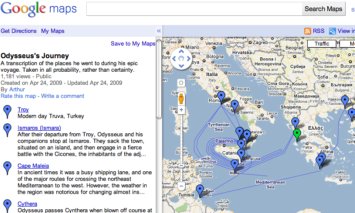
It is not necessary that this literary cartography be limited to the modern or postmodern world, although the conditions arising from modern or postmodern developments might make a more expressly cartographic project more desirable. Undoubtedly, the ancient world knew spatial anxiety and disorientation as well—think of Odysseus’ wanderings.

But the ancient world had a perceived wholeness that made it inherently “mappable” in the minds of its people, whether through metaphysics, politics, or geography; the epic had what Joseph Frank called a spatial form, as the organization of events depend less on chronology than on locations within a fixed universe. With the modern condition, in contrast, this totality is no longer given. As Lukács puts it, “The epic gives form to a totality of life that is rounded from within; the novel seeks, by giving form, to uncover and construct a concealed totality of life” (60). Modernity, at least as understood by this tradition, occasions a breakdown in the sense-making systems that had come before. For instance, Michel Foucault’s discussion of the breakdown of Renaissance signifying systems focuses on Don Quixote, a novel that exhibits a transcendental homelessness and cartographic anxiety throughout (see Foucault 47–48). Narrative may have always been a way of orienting ourselves, both in the relatively stable semantic universe of Lukács’s closed civilizations or in the Quixotic modern world where the center does not always hold, but navigating the postmodern world may be most difficult, as even the provisional maps of the modern era are subject to ever more intensive deconstruction (see Harley).
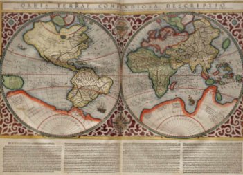
Jameson’s “digression on cartography” in his discussion of postmodernism is instructive in this regard. Whereas ancient maps were often merely diagrams of an individual traveler's journey, the medieval discovery of the compass (among other things) allowed for “the coordination of existential data [...] with unlived, abstract conceptions of the geographic totality,” and such modern advances as the globe and the Mercator projection emphasized the problem of representation itself, disabusing us of “naively mimetic conceptions of mapping” as “it becomes clear that there can be no true maps,” only more or less useful ones (Postmodernism 51–52). Similarly, in narratives, one might also differentiate the straightforward “truth-telling” testimony of individual eyewitnesses based on their necessarily limited empirical evidence to a broader conception of the individual’s relationship to the unlived totality, and eventually to a conception of representational art itself, which must explore other fictional, perhaps fanciful, techniques in order to achieve its aims. With Mercator’s distorted map, the exaggerated representation of space—for instance, depicting Greenland as the size of South America—serves the practical purposes of navigation, particularly with respect to determining longitude, the great terror of fifteenth- and sixteenth-century maritime navigation.

“True maps” of the old, mimetic sort, are less useful. Of course, all maps are fictions; even Jorge Luis Borges’s fabled imperial cartographers in “On Exactitude in Science,” who made a map coextensive with, and even more detailed than, the space it purported to represent, were unable to create “true maps.” But with modern cartography, fictions are also functions.
In literary narrative, the writer maps the world in a similar manner, often coordinating the existential data of the individual writer’s or protagonist’s experience with the unknowable and seemingly unrepresentable social totality. For example, in Melville, Mapping and Globalization, I argue that Melville developed his literary techniques in Moby-Dick partly in response to his frustration over the limitations of his personal narrative form in such early works as Typee or Redburn. Melville required a different approach, which was explicitly cartographic in attempting to represent “spaces that before were blank” and to provide a bird’s-eye view unavailable to the “plodding” pedestrians below. (A different perspective on this same cartographic impulse may be found in Michel de Certeau’s analysis of “Walking in the City” in The Practice of Everyday Life.) The artful presentation and representation of “true places” requires a projection beyond the bounds of simpler testimonial writing (see Tally 86–101).
Projection, in literature as in cartography, allows one to make sense of, or give form to, a world in order to make it legible. In Thomas Pynchon’s The Crying of Lot 49, Oedipa Maas wonders: “Shall I project a world? If not project then at least flash some arrow on the dome to skitter among constellations and trace out your Dragon, Whale, Southern Cross. Anything might help” (81–82). As this suggests, a constellation—imaginary lines drawn among stars to make sense of the skies—is another apt figure for this narrative process of literary cartography; an imaginary sense-making system, the constellation is, of course, essential for celestial navigation. In that novella, the conspiracy itself operates as a sort of map to be read; it projects a totality that becomes a way of understanding the seemingly indecipherable codes and figures that bombard Oedipa Maas in her odyssey.
If the writer is a mapmaker, the critic is a map-reader, who (like all map-readers) also creates new maps in the process. In La géocritique mode d’emploi, Bertrand Westphal and his research team emphasize the inter-relations of writing and geography, using the term “geocriticism” to label a set of critical practices involving the spaces of literature, real and imagined. As Westphal puts it, “Literary space, in the end, is a real, material, geographical place, imagined and represented by language. The vocation of geocriticism is to interpret the manifestations of this spatial imagination, at the intersection of geography and literature” (x, my translation). Other critics have engaged in similar projects in recent years. Postcolonial critics have long been involved in what Edward Said called, in Culture and Imperialism, “a geographical inquiry into historical experience” (7), in response to the perception that “most cultural historians, and certainly all literary scholars, have failed to remark the geographical notation, the theoretical mapping and charting of territory that underlies Western fiction” (58). Franco Moretti’s work on the Atlas of the European Novel 1800-1900 has revealed how the Paris of Balzac or the London of Dickens are mapped in their novels, and Moretti’s use of narrative maps to chart the development of novelistic chronotopes offers a fascinating, if somewhat bizarre, model for literary historical research (also see his Graphs, Maps, Trees). Another recent intervention, Eric Bulson’s Novels, Maps, Modernity examines how Melville, Joyce, and Pynchon used actual maps and guidebooks in developing new literary techniques as foundations for realist, modernist, and postmodernist orientations. Literary criticism, history, and theory are already becoming attuned to operations of literary cartography in narrative, and elsewhere. As readers and writers, we navigate our world by mapping it.
Works Cited
Borges, Jorge Luis. “On Exactitude in Science.” Collected Fictions. Trans. Andrew Hurley. London: Penguin, 1998. 365. Print.
Bulson, Eric. Novels, Maps, Modernity: The Spatial Imagination, 1850–2000. London: Routledge, 2006. Print.
Certeau, Michel de. The Practice of Everyday Life. Trans. Steven Rendall. Berkeley: U of California P, 1984. Print.
Foucault, Michel. The Order of Things. Trans. anon. New York: Vintage, 1973. Print.
Harley, J.B. “Deconstructing the Map.” Cartographica 26.2 (Summer 1989): 1–20. Print.
Heidegger, Martin. Being and Time. Trans. John Macquarrie and Edward Robinson. New York: Harper and Row, 1962. Print.
Jameson, Fredric. The Political Unconscious: Narrative as a Socially Symbolic Act. Ithaca: Cornell UP, 1981. Print.
---. Postmodernism, or, The Cultural Logic of Late Capitalism. Durham: Duke UP, 1991. Print.
Lukács, Georg. The Theory of the Novel. Trans. Anna Bostock. Cambridge: The MIT P, 1971. Print.
Moretti, Franco. Atlas of the European Novel, 1800–1900. London: Verso, 1998. Print.
---. Graphs, Maps, Trees: Abstract Models for a Literary History. London: Verso, 2005. Print.
Pynchon, Thomas. The Crying of Lot 49. New York: Harper & Row, 1990. Print.
Tally, Robert T. Melville, Mapping, and Globalization: Literary Cartography in the American Baroque Writer. New York: Continuum, 2009. Print.
Turchi, Peter. Maps of the Imagination: The Writer as Cartographer. San Antonio: Trinity UP, 2004. Print.
Westphal, Bertrand. “Pour une approache géocritique du textes.” La géocritique mode d’emploi. Ed. Bertrand Westphal. Limoges: Presses Unversitaires de Limoges, 2000. Print.
Figures:
1. Fantin-Latour, Henri. “The Two Sisters.” 1859. Saint Louis Art Museum, St. Louis, Missouri. Web. Wikimedia Commons. Web. 16 Jan. 2011.
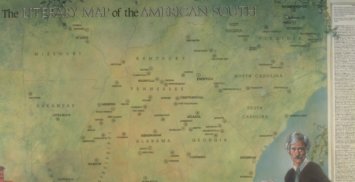
2. Blake, Aaron. “The Literary Map of the American South” (1988). Illus. Linda Ayriss. Language of the Land: Journeys into Literary American. Library of Congress, Washington D.C. Web 16 Jan. 2011.
3. Arthur. “Odysseus’s Journey: A Transcription of the Places He Went” (24 Apr. 2009). Google Maps. Web. 21 Jan. 2011.
4. Mercator, Rumold. “World Map” (1587). Wikimedia Commons. Web. 15 Jan. 2011.

