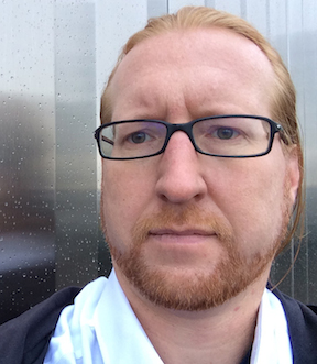
Walking the Everyday
by Matthew Bissen
published November 2014
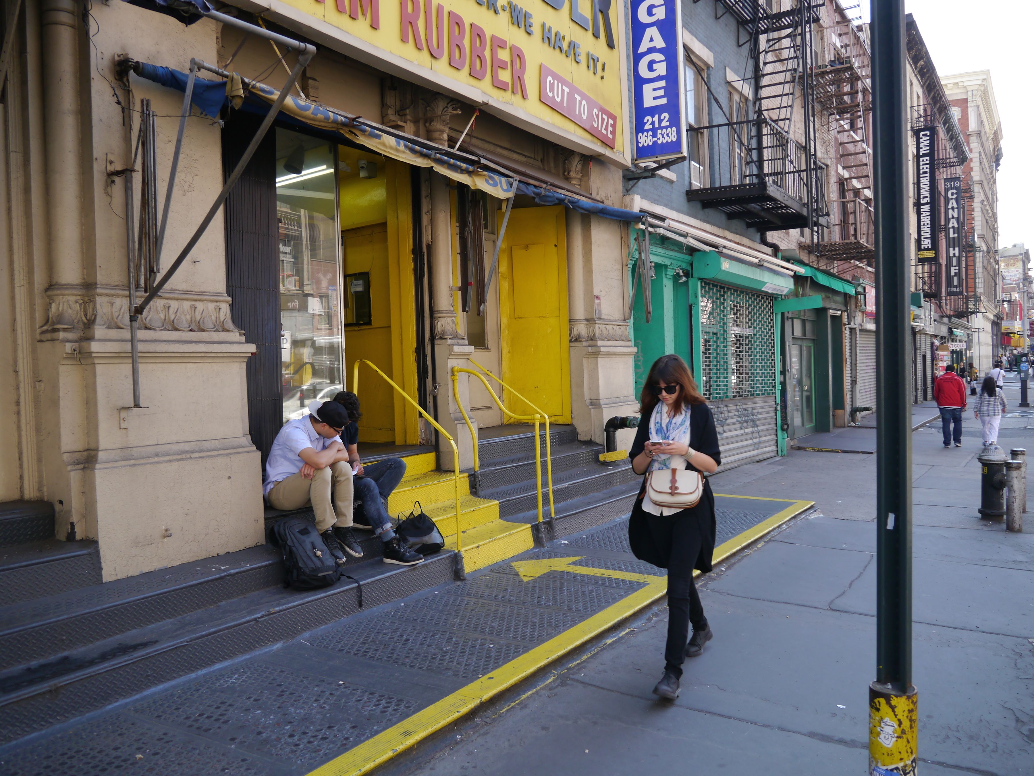
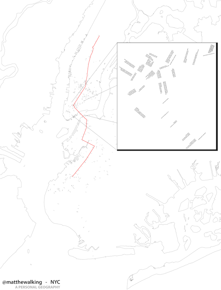
Fig. 1: June 7th 2012: “NYC-Canal(w)-Centre. Starting at the center and moving toward the edge.” (@matthewalking)
Part 1
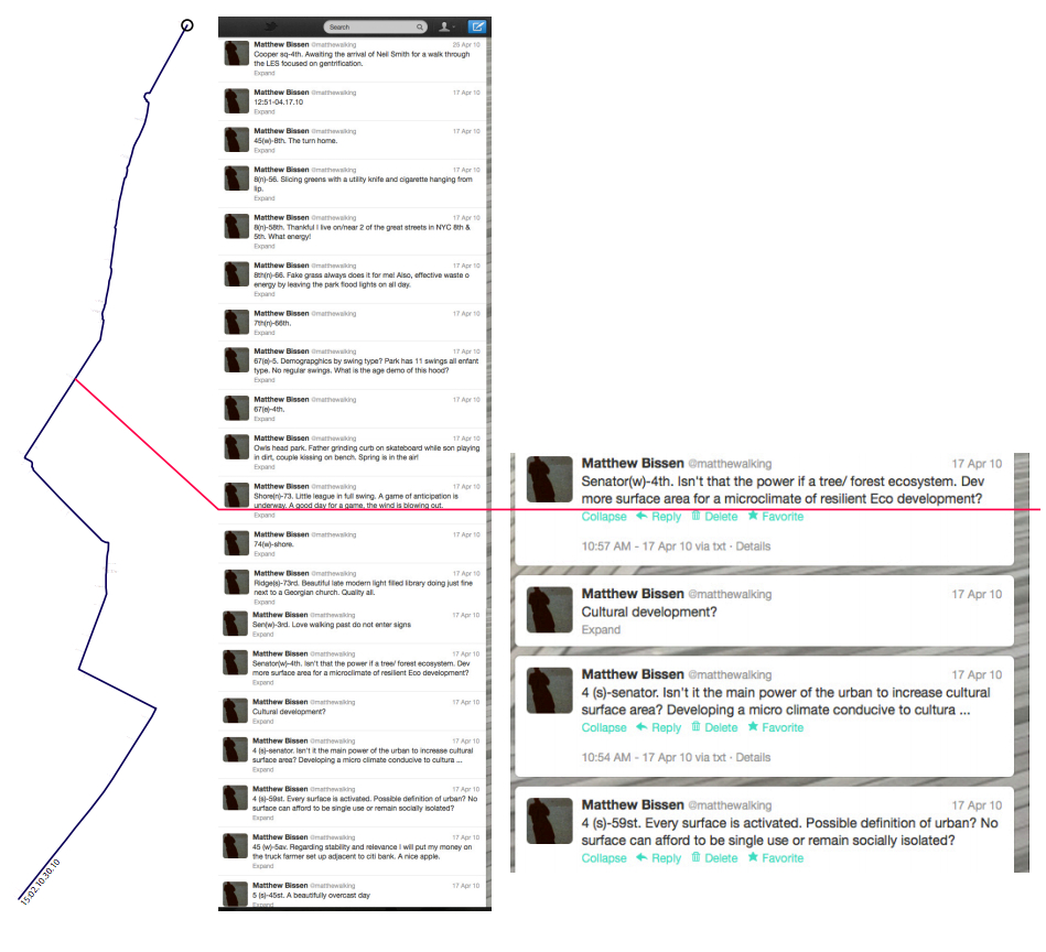
Since 2010, @matthewalking (Bissen, 2013) has published real-time public texts of walks in the city. This text-based Twitter feed has developed a narrative of a particular everyday life and developed a space of interface with others that represents a centering of perspective within an urban landscape. Walking the city provides a spatial, tactile, social, and embodied knowledge of the environment as each of us emerges into a space, orients ourselves, and determines a path that is highly localized, but is in connection with distant spaces and cultures (see Figure 1). According to Ben Jacks in “Walking the City: Manhattan Projects,” “for urban dwellers and designers, walking is a fundamental tool for laying claim to, understanding, and shaping a livable city. Walking yields bodily knowing, recovers place memory, creates narrative, prioritizes human scale, and reconnects people to places” (75). @matthewalking’s walks, at times for as long as 5 hours, attempt to center an experience of an urban existence in a spatial narrative of the city that at once prioritizes a connection to place, but also is projected outward into a mediated relationship with others. The project is a series of unbounded walks, or dérives (drift), through the city that are logged on Twitter and traced to create an archive map of a set of particular urban experiences. The dérive concept as outlined in “The Theory of the Dérive,” by Guy Debord is when “one or more persons during a certain period drop their relations, their work and leisure activities, and all their other usual motives for movement and action, and let themselves be drawn by the attractions of the terrain and the encounters they find there” (62). This approach developed by The Situationist International is the origin of this spatial narrative project. Each tweet is geo-tagged (City-Street Walking (Direction)—Nearest Cross Street. Text.) in order to record the spatial location of the walker and publish the thoughts which have occurred in the space (see Figure 3). The immediacy of the tweet and 140 character limit allows the text, as much as possible, to be a part of the act of walking and reduce the distance between experience and publication. The tweet also creates a marker, or pivot, in thought and space from which the narrative of an experience emerges. Manuel Castells emphasizes the importance of theses markers when he states, “[t]he process of urban exchange comprises both a system of flows, that is to say, circulation, and of ‘turn-tables ’ of communication, that is to say, centers” (226). The @matthewalking feed establishes a narrative centered on a trajectory of spatial movement that is communicated and exchanged through a series of turn-tables of thought and orientation. The feed generates a spatial narrative that continually pivots and reconstitutes itself in space and media while walking the city.
Part 2
Orientation, as outlined by Stephen Hall in “I, Mercator” is a critical first step with any experience of space (see Figure 2). “Orientation begins with geography, but it reflects a need of the conscious, self-aware organism for a kind of transcendent orientation that asks not just where am I, but where do I fit into this landscape? Where have I been? Where shall I go, and what values will I pack for the trip?... The coordinates marking this territory are unique to each individual and lend themselves to a very private kind of cartography.“ (15). This view pushes us to see coordinates not as abstract Cartesian points in space, but as a marking of a conscious being that is contingent on a particular position, state, values, and perspective. This orientation signifies where we are located, but is also critically the position from where we act. If cartography is to employ a transcendent orientation in the representation of personal geographies, the first orientation to consider is that of the cartographer. James Corner articulates in “The Agency of Mapping: Speculation, Critique and Invention” how cartographers and the maps they produce are perceived “as expertly produced, measured representations... conventionally taken to be stable, accurate, indisputable mirrors of reality” (214). For this mirror to be relevant to our orientation, it is important that mapping not only constructs an active connection between the author and the reader that is beyond static abstract contour lines, but also engages the experience and movement along the contours. Corner continues that mapping functions “not to depict but to enable, to precipitate a set of effects in time. Thus, mappings do not represent geographies or ideas: rather they effect their actualization” (225). Mapping in contemporary open-source frameworks enables readers to actualize and represent their experience as they navigate a space. Online mapping sites, such as Google Maps, now include multiple layers of personal geographies that aid others in their process of orientation. Robert Tally provides an illustrative example of this interpretation in his development of Odysseus's hypothetical wanderings in Google Maps. The contours of these maps are not limited to terrain or abstract Cartesian coordinate logic, but function as a spatial armature for experience to be attached, represented, and narrated. These layers contribute descriptions of the space, values placed on locations, and first-person-based images onto the base mapping via the contributions of individual actors. The more one interacts, and contributes to these mappings, the more one begins to produce a narrative of experience from where one is located beyond the abstract line, a narrative line thickened to include imagery, text, hyperlinks, and/or historical information.
These active narrative contours are not a new movement in mapping but as outlined by David Livingstone in The Geographical Tradition link back to the historic production of Portolan Maps in the Medieval and Renaissance periods which “preserve the Mediterranean sailors' first hand experience of the sea” (41). These experiential techniques were replaced by more rigorous mathematical approaches, but now are emerging again due to the capacity of digital mapping to simultaneously hold abstract and experiential sets of information. This allows for both narrative and Cartesian logic to be present in tracing our engagement with the environment. This narrative cartography is providing the ability, as desired by Michel de Certeau in The Practice of Everyday Life, to “follow the thicks and thins of an urban text” (93) through multiple streams of spatial and experiential information from which various actors can contribute their own thick description and create contour lines of increased resolution and relevance as a mirror of reality.
Part 3
Contemporary media feeds are emerging to contribute to the mapping of space through descriptive logs which are not reliant exclusively on cartographic representation. In the past, spatial boundaries and knowledge relied heavily on the ability to describe, through text, a path of movement through the environment. This role of narrative is one of the foundations of cartography which Michel de Certeau in The Practice of Everyday Life privileges in his concepts of tours over the map: “In particular, if one takes the 'map' in its current geographical form, we can see that in the course of the period marked by the birth of modern scientific discourse the map has slowly disengaged itself from the itineraries that were the condition of its possibility” (120). The disengagement with itineraries, and the narration of a spatial experience, is the condition which has provided the inherent power to the abstract Cartesian system to distort and control. De Certeau called for the subversion of the power of the visual cartographic approach by privileging the “tour” over the map. Media feeds through their production of descriptive logs are beginning to provide a medium for this subversion to take place. To reduce the contrast in the dualistic frame between tour and map, which de Certeau establishes, it is beneficial to consider cartography not as separate from, but defined by, a log of experience. This base of narrative in cartography is evident in the linking of turn-by-turn directions and experience into digital maps. Current mapping sites such as Google Maps are able to represent experience, movement logs, and abstract spatial representations for the viewer in one interface. The abstract point in space is still the dominant representation to establish where one is located in space, but the full value of these maps is the foundation of narrative and experience that is revealed to aid a person in self-orientation. As questions shift from where am I, to how did I get here? And, from what is there to what is the value of a place? The cartographic representations become less and less vital to the user and the digital mapping programs shift to descriptive narrative in order to maintain relevant validity to the user. The line on the map is not sufficient to convey the spatial experience and to answer the question of orientation. The log was not always secondary to representing space but historically preceded the cartographic representation. Many spatial narratives remained logs or stories and rarely have become a cartographic representation. The mapping remained the text or a physical re-creation of a narrated route. Legal representation methods also reinforce the idea that a narrative log can never be fully removed from the establishment of a line, boundary, or space. The continued use of metes and bounds techniques in survey records is at the core of how we know and establish property boundaries.
A passage from the 1811 New York City commissioners report establishing the Manhattan grid is a classic example of the connection between a survey log and a physical survey: “[t]he northerly side of Eighth Street touches the southwest corner of a house built on the northerly side of Stuyvesant Street...The southerly side of Sixteenth Street touches the southerly side of Monument 16, placed near the western side of Bloomingdale Road” (Morris, De Witt & Rutherford 6). The map of the grid is a secondary archive of the survey process and the 1811 experience. While the map attempts to fix the boundaries through visual representation, the monuments and narrative remain the record and are rooted to a particular place and experience. Metes and bounds descriptions are still the legal definition on property deeds, not the map. This legal structure still privileges the narrative as the base and primary representation of space. @mathewalking privileges the narrative log as the base representation of the space with a two-year delay in any visual representation of the walks (see Figure 3). The walks are based within the experience and unfolding of the space with the log functioning as the primary representation of the route allowing each reader to experience their own unfolding by walking the log. This pause before producing a visual representation of the narrative in a plotted line allows the log, experience, and imagination to produce a space before it is reduced into the dominant visual medium of a map.
Part 4
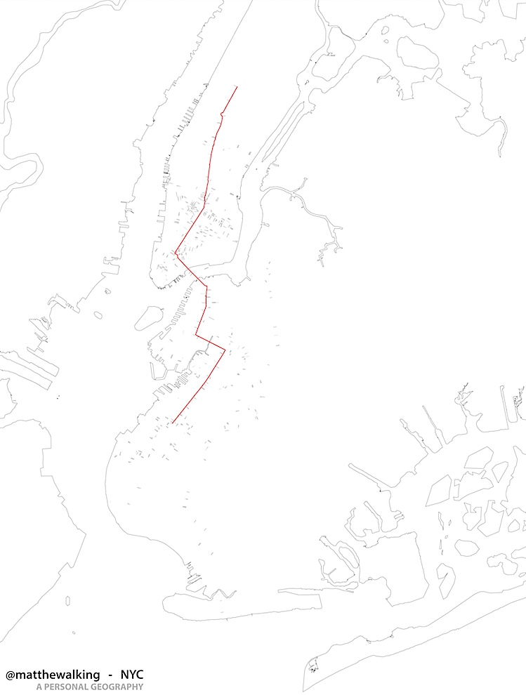
Narrative logs can be viewed as more than a text, they can be viewed as a collection of tracings in the physical and media landscape. In this case, a trace is a 140 character mark or text in the Twitter feed which represents a space through two distinct layers. First, through a geographic code in the tweet that marks a spatial tracing of movement is revealed. This line records and represents a mapping of a particular personal geography of New York City. Further, these lines can represent patterns of counter-topography relative to the normative narrative of the city. However, Michel de Certeau and James Corner caution that an attempt to draw out particular patterns in the city should not be limited to the line. “These enunciation operations are of an unlimited diversity. They therefore cannot be reduced to their graphic trail” (de Certeau 99). “These [lines] are more 'tracings' than maps, delineating patterns but revealing nothing new” (Corner 213). Both de Certeau and Corner critique the typical drive to reduce the diversity of intertwined narratives of space into abstract lines. These critiques are well founded and call into question why the log and the line cannot be more integrally linked in their representation. The second aspect of the Twitter trace is the physical or media remnant of thought within the log that produces the line. These remnants of lived experience are more than just a GPS tracking of movement, but are portals into the culture and experience of place (see Figure 4). These trace thoughts, inspired by James Corners, in a small way “inaugurate new grounds upon the hidden traces of living context... and what already exists is more than just the physical attributes of terrain (topography, rivers, roads, buildings) but also includes the various hidden forces that underlie the working of a given place” (213). Places are now constituted and produced through the experience of both underling physical traces and emerging digital traces represented in media logs. The understanding of a place by focusing on physical traces to reveal its history and meaning can be seen in Everything Sings: Maps for a Narrative Atlas by Denis Wood. A close reading and mapping of a place can reveal that a “neighborhood's a thing (or it's a collection of things) but it's also a process, an ongoing commingling of regular routines that slowly shift over time, accumulating history” (19). Wood foregrounds what can be learned from the environment and culture with a focused attention on the layers of traces in the landscape. This physical approach to mapping, however, is no longer a full spectrum of history and must begin to be layered with media traces and logs which increasingly constitute a significant portion of our knowledge of place. Mappings are now collections of physical and mediated experiences that situate ourselves and our narrative in place.
Part 5
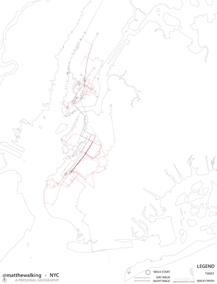
By plotting these mediated traces of the everyday as transects across the city, it is possible to enunciate an array of experiences and knowledge of a place. Traces allow for an engagement with the direct experience through physical and media traces that build up a milieu of individual relationships with others (see Figure 5). Critical to these relationships is the nature of the media and of the spatial practice. As we continue to gain the ability to participate in mapping and media, historical concepts can inform how we understand our media and spatial environment. Plato's allegorical cave is one such representation that helps us to question how we know our environment and how we practice our everyday life. In the cave, the experience of reality was mediated and determined through a limited physical position. Being chained in place with back to the fire and a fixed view of the cave wall in front of you resulted in a reality constituted of projected shadows cast from your body and others onto the wall. This reality is specific to orientation and media that dominate an understanding of existence. An understanding which is only shifted by being released from the fixed orientation and media to experience and thus understand the full extent of the world in which one inhabits.
Our orientation is no longer from a fixed view or medium, but is evolving to include related physical and media positions. Gumpert and Drucker illustrate this evolution when that claim that “today, the reality of the street and the city has been transplanted by the illusions of virtual reality and mediated communication. The 'see and hear contact' settings are being transcended through media contact” (115). These evolving contact settings are expanding knowledge of an existence in spaces and cultures which require a continuous effort to understand how our experience is being mediated. A continual understanding of a position which is no longer allegorically fixed as in Plato's case but in a constant positioning of body and interface to produce a media of contact. Through the engagement of social media by contributing images and feeds that enunciate our experience of places, we develop mappings that are mutually defined through our experience and our media. Use of Twitter and other social media to narrate and represent experience allows us not only to re-conceive the normative map to be reoriented, as the situationists advocated, but also to construct our experience to be experienced again. This new orientation is not a static trace but an active intertwining of space and narrative in real time with others.
This returns us to de Certeau and his desire to walk in the city. In The Practice of Everyday Life he descends back down from atop the World Trade Center to be situated in the urban milieu rather than remain decontextualized from others below occupying the city. He questions the desire and the ability to view the city from the summit that transfigures one into a voyeur and transfigures a view of the city into a fiction of knowledge. From this vantage point of being a voyeur, Manhattan can continue to be constructed as a fiction that creates readers and makes the complexity of the city readable. This legibility does not prove a source of knowledge but immobilizes the opaque mobility of the city into a transparent text (92). Similar to how Corner re-conceives the stability and authority of cartography and the typical Cartesian view from above, de Certeau moves back down into the city to privilege experience and situated media and through the layers of unique and opaque experiences we can move beyond environments which are viewed and thus conceived of as neutral and transparent to the social dynamics which produce them through everyday actions and concerns.
Now that this analysis is down on the ground, Jane Jacobs and Mary Louise Pratt contribute to understanding that walking down a sidewalk is both mediated and physical and must be viewed as an intertwined area of contact and contact zones. To be able to read and participate in an opaque mobility, we must move away from the idea that urban experience and media are transparent and neutral. We must develop ways to orient ourselves within these contact zones, which are, as Pratt states, “social spaces where cultures meet, clash, and grapple with each other, often in contexts of highly asymmetrical relations of power” (33). In this context acts of narrative and cartography situated in space become a tools which can aid in orientation and the navigation of asymmetrical relationships of power and opaque perspectives in order to develop social contact. Urban trajectories function to engage and expand these contact zones beyond the body via narrative cartographies. A walk is only one transect through such environments, but the fact that it can be published in real time allows others to be in contact with this enunciation of space as it becomes the milieu of the city. These moments and positions are now known and connected to multiple actors, thus reducing barriers to enable new ways to contact others.
Part 6
As media becomes more closely linked to urban trajectories, the concepts narrative and cartography become more important to our understanding of urban possibilities. Touching Water (see Figure 6) recalls the complexity of these trajectories, while also revealing an essential nature of our interface with the environment. What compels a desire to touch water? Is the water cold? Is it clean? Can I drink it? All these questions arise when approaching a boundary that requires one to orient oneself to act. This questioning occurs in everyday activities and is a constant requirement to navigate the boundaries approached in the everyday. Taken at distance these boundary orientations rarely garner attention. But in the act of reaching out to touch water a potentially constructive connection is developed between the essential nature of water and the everyday mundane nature of water. Water is a medium which flows between the abstract and the mundane. In various cultures water is touched in order to bless or to cleanse. It is touched to clean food for eating. It is touched to clean ourselves to prepare for the everyday and as we close our eyes to dream. To touch water is in a sense an opaque act that reveals the complexity developed as we walk our everyday narrative and cartography. Revealing questions of who can touch water? Is the water I touch polluted to the point of harm? How am I polluting this water? These interactions raise important questions in our daily lives, but tend to arrive only at water that is distinctly outside of one's experience. One way to begin to answer these questions is to reach toward it, touch it, and dangle a hand into the flow. This provides a way to develop contact and begin to understand these “other” conditions within this newly developed zone of contact. The ability of media, emerging from historic cartographic methods, to represent and locate everyday narratives and reveal boundaries to develop traces for us to orient ourselves to establish contact as we walk the city with others.
Works Cited
@matthewalking (Matthew Bissen). “NYC-Canal(w)-Centre. Starting at the center and moving toward the edge.” 7 June 2012. 9:12 a.m. Tweet.
@matthewalking (Matthew Bissen). “Hudson(s)-13th St. Lose the trace find the trace this will be a difficult walk. Concrete is a good erasure.” 19 Sept. 2010, 10:20 a.m. Tweet.
@matthewalking (Matthew Bissen). “NYC- 5th (s)-45st. A beautifully overcast day.” 17 Apr. 2010, 9:15 a.m. Tweet.
@matthewalking (Matthew Bissen). “Spring(w)-Varick. Like walking along a series of portals and peering deep into the soul of New York.” 7 June 2012, 10:05 a.m. Tweet.
@matthewalking (Matthew Bissen). “Lettenstag(s)-Limmat River. It takes time and space for two to become one.” 8 June 2012, 1:30 a.m. Tweet.
@matthewalking (Matthew Bissen). “Limmetquai(e)-42. Touching water.” 8 June 2012, 11:04 a.m. Tweet.
Castells, Manuel The Urban Question, Cambridge MA: The MIT P, 1979. Print.
Certeau, Michel de, The Practice of Everyday Life, Berkeley CA: U of California P, 1984. Print.
Corner, James. “The Agency of Mapping: Speculation, Critique and Invention.” Mappings. Ed. Denis Cosgrove. 213-52. London: Reaktion, 1999. 213-52. Print.
Debord, Guy. “The Theory of the Derive,” Situationist International Anthology. Ed. Ken Knabb. Berkeley, CA: Bureau of Public Secrets, 2006. 62-66. Print.
Gumpert, Gary and Susan Drucker, “The City and the Two Sides of Reciprocity.” Augmented Urban Spaces: Articulating the Physical and Electronic City. Eds. Alessandro Aurigi and Fiorella de Cindio. Burlington VT: Ashgate P, 2008. 113-124. Print.
Hall, Stephen S., “I, Mercator.” You are Here: Personal Geographies and Other Maps of the Imagination. Ed. Katherine Harmon. New York: Princeton Architectural P, 2004. 15-35. Print.
Jacks, Ben. “Walking the City: Manhattan Projects.” Places 18.1 (2006) 68-75. Print.
Jacobs, Jane. The Death and Life of Great American Cities, New York: Random House, 1961. Print.
Livingstone, David N. The Geographical Tradition, Oxford: Blackwell, 1992. Print.
Pratt, Mary Louise, “Arts of the Contact Zone.” Professions 91 (1991): 33-40. Print.
Wood, Denis. Everything Sings: Maps for a Narrative Atlas. Los Angeles: Siglio P, 2010. Print.
